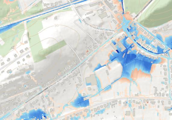
Drone images of recent floods
Drone images of recent floods provide an excellent reality check of pluvial flood maps
Drone images of recent floods provide an excellent reality check of pluvial flood maps
In 2017, HydroScan was commissioned by the Flanders Environment Agency (VMM) to draw up a regional map for Flanders showing pluvial flood plains. These are areas which have increased risk of flooding due to direct rainfall on the ground.
The recent flooding of May 2018 provided an excellent opportunity to test this demarcation, the result of complex hydraulic models, against the flooding which was seen in situ. During a number of periods of intense rainfall, VMM used drones to map the extent of the flooding. The data showed that the areas where floods were predicted very often corresponded to the actual flooding itself. This shows that these maps can be a very useful tool in the context of operational flood management and policy making. HydroScan is currently working on a follow-up project in which the maps will be slightly improved and adopted into Flemish water policy. It is expected that the maps will be available by summer 2019. You can find more information on the VMM website (https://www.vmm.be/nieuwsbrief/juni-2018/vmm-brengt-overstromingen-in-kaart-met-drones) or through HydroScan (https://www.hydroscan.eu/).

Call or mail us
Interested? How can we help you?
Do not hesitate to tell us about your situation or ask any questions you may have.
To also know that, in most situations, we can identify your real needs and suggest the most appropriate solution based on a first quick scan.
Send an email or call +32 16 24 05 05.
![[:swvar:ufile:1:description:]](/swfiles/files/logo_hydroscan_rgb.png?nc=1745319552)
